Expert article
Expert insights: Why real-time weather data is critical for safe Arctic maritime operations
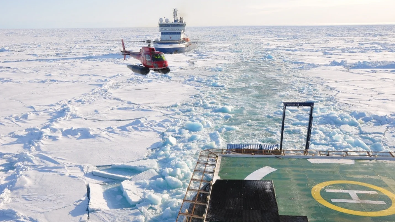


Interview with former Arctia icebreaker Master Mariners captain Toni Kovanen and 1st officer Juha Tuomi
Operating in Arctic waters leaves little room for uncertainty. Ice, wind, waves, low visibility, changing pressure, and vessel motion all influence operational decisions — especially when the vessel is supporting icebreaking, offshore work, dynamic positioning, or helicopter operations.
To better understand what arctic operations demand from people, vessels, and technology, we spoke with Juha Tuomi and Toni Kovanen, a long-time icebreaker and offshore vessel professionals with decades of experience in Arctic and demanding maritime environments. Their careers have included work on Finnish icebreakers and multipurpose icebreakers, as well as shipping operations in areas such as Alaska, Svalbard, the Northwest Passage, the North Sea, Brazil, Angola, and the Mediterranean.
The discussion highlighted one clear message: in harsh maritime environments, reliable local weather and environmental data are not just helpful. They are an essential part of safe decision-making.
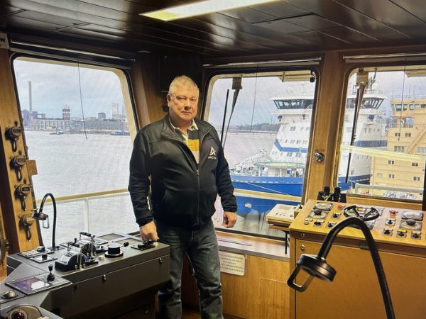
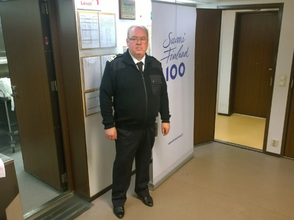
Could you tell us about your background and experience in Arctic maritime operations?
Toni: I started my maritime career in 1979 and spent more than 46 years at sea. From 1981 to 1997, I sailed on Gustaf Erikson’s vessels, operating on routes around the world. In 1997, I joined what later became Arctia and worked on Finnish icebreakers and multipurpose icebreakers, including Fennica, Otso, and Voima. Over the years, I served as chief officer and captain, with experience from offshore projects in many parts of the world and Arctic operations in areas such as Alaska and Svalbard.
Juha: I started at sea in 1979, first in crew roles, and later qualified as a deck officer and master mariner. My career included offshore tanker operations, offshore work, and icebreaking on vessels such as Fennica, Nordica and Botnica. I have worked in Arctic operations in Alaska and sailed the Northwest Passage in 2017, with much of my experience focused on the Northern Hemisphere.
What makes Arctic vessel operations especially challenging?
One of the biggest challenges is the ice itself. In the Arctic, especially in areas with multi-year ice, the ice can be extremely hard compared to the ice typically encountered in the northern Baltic Sea. It does not always move in the same way, but when a vessel meets hard multi-year ice, the impact on the ship can be significant.
In Arctic operations, the vessel may also be subject to strict route limitations. During the Northwest Passage transit, Canadian authorities defined where the vessel was allowed to go, particularly if there was too much multi-year ice in certain areas. This demonstrates how ice information, local expertise, and regulatory requirements all shape operational planning.
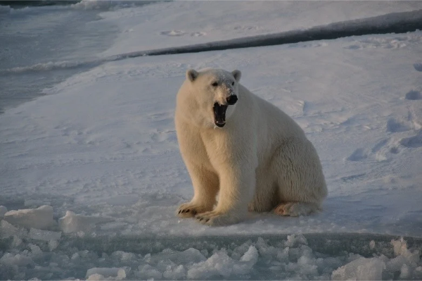
Environmental protection can also influence operations. In Alaska and Arctic areas, wildlife observers monitored marine mammals and other animals from the bridge. If whales were observed ahead of the vessel, the operation could be slowed, altered, or stopped.
How quickly can weather and environmental conditions change in Arctic and offshore operations?
The rate of change depends heavily on the area. In some Arctic areas, weather changes may be less sudden than in other maritime environments, but storms still occur and can be severe. In the Aleutian and Bering Sea region, storms can arrive quickly and be very intense.
In offshore and open-sea operations, rapid changes can be dramatic. Tuomi described situations where wind increased from about 8 m/s to 28 m/s all of suddenly, before dropping again after a short period.
Severe weather is not only about wind speed. Vessel motion, wave direction, and the vessel’s ability to maintain heading can become critical. One of the most dangerous situations is a blackout in heavy weather, when propulsion and electrical power are lost and the vessel can no longer keep the bow into the wind and waves.
Which weather and environmental parameters are most important for safe operations?
Wind speed and wind direction are among the most important parameters, especially for vessel handling, helicopter operations, and dynamic positioning. For helicopter operations, however, wind is only one part of the picture. Cloud height, visibility, vessel roll, pitch, and heave are also critical.
Air pressure is also useful, particularly when it changes quickly. A rapid rise or fall in pressure can indicate that unusual or challenging weather is approaching. On board, pressure, wind speed, and temperature are recorded regularly in the ship’s log.
For icebreaking, ice conditions remain a decisive operational factor. Satellite imagery is now widely used to identify ice conditions and plan routes, replacing much of the earlier helicopter reconnaissance work where observers manually marked ice ridges and conditions on charts.
How is real-time onboard weather data used in operational decision-making?
Real-time onboard weather data helps crews compare forecasts with actual local conditions. This is especially important at sea, where nearby coastal weather stations may not reflect what is happening around the vessel.
Kovanen explained that during ocean crossings and offshore projects, vessels often send regular observations to weather routing services. The weather service then compares the actual conditions with forecasts and updates routing recommendations accordingly.
This type of feedback loop is valuable because it improves situational awareness and supports better decisions. Forecasts are essential, but local observations help validate what is really happening at the vessel’s position.
Why is local weather data especially important for helicopter operations?
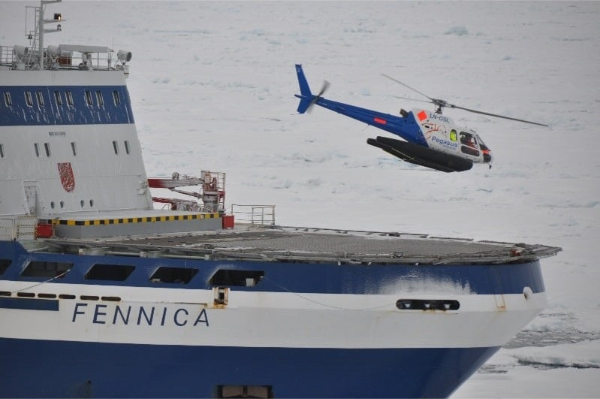
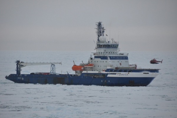
Helicopter operations are one of the clearest examples of why real-time local weather data matters. Before a helicopter departs, the vessel must send weather and helideck condition information to the heliport or flight operations team. This includes parameters such as wind, cloud height, visibility, and vessel motion.
Before modern weather systems were installed, crews sometimes had to estimate conditions manually. Kovanen described earlier operations where cloud height had to be assessed visually, sometimes with help from people who had aviation experience. After Vaisala weather stations and Helideck Monitoring Systems were installed on Nordica and Fennica, the reporting process became much more accurate and automated.
In Alaska, helicopter flights could be delayed by rapidly changing fog and visibility. In one crew-change situation, multiple flights had different outcomes within a short period: one flight reached the vessel, another had to return because of fog, and a third flight was delayed until the weather finally allowed safe arrival.
This illustrates why real-time local information is so important. A forecast may suggest that conditions are acceptable, but if the weather changes within an hour, the operational decision must be based on what is happening at the vessel.
What role does vessel motion data play in helideck safety?
For helicopter landing decisions, the vessel’s motion can be just as important as the weather. Roll, pitch, and heave indicate how the helideck is moving. If the vessel’s motion exceeds safe limits, the helicopter may not be able to land safely.
Tuomi described how crews may turn the vessel to find a more favorable heading and reduce helideck movement. The sea state may remain the same, but by changing the vessel’s angle to the waves, the crew may be able to bring motion within acceptable limits.
He also emphasized that the vessel’s motion should be monitored over a period of time before making the landing decision. A single moment may not tell the full story, especially if occasional waves cause sudden movement.
How does automated reporting improve safety?
Automated reporting reduces the risk of human error and makes it harder to adjust or interpret data subjectively. Tuomi noted that one useful feature of modern HMS reporting is that the data is captured and sent as it is, rather than being manually edited to make conditions appear more favorable.
This matters because offshore operations can involve commercial pressure, tight weather windows, and customer expectations. In such situations, objective data helps support safe decisions, even when people are under pressure to continue the operation.
What are your experiences with Vaisala weather systems and HMS?
The experience has been positive. Tuomi described the Vaisala weather station as a “fine device” because it provides real-time information, including cloud height and other key parameters used in operational reporting.
He also highlighted the importance of heated sensors in winter conditions. In icebreaking and Arctic operations, sensors must continue working in freezing temperatures, spray, humidity, and icing conditions. According to Tuomi, sensor heating is very important, and the Vaisala wind sensor performed well in situations where other sensors could become iced or blocked.
The systems can also be integrated with other onboard systems. On Nordica, data from the Vaisala weather station was connected to the navigation system, allowing the crew to access the information through operational displays.
Why does Finnish icebreaking expertise matter internationally?
Finland has long experience in icebreaking because ice is a recurring part of maritime operations in the Baltic Sea. That creates a practical need to design, build, operate, and continuously improve icebreakers and ice navigation practices.
Kovanen emphasized that Finland remains strong in icebreaker design and construction, and that Finnish icebreaking expertise is supported by the country’s operating environment: the Finnish coast freezes, maritime traffic must continue, and icebreakers are needed every winter.
The Gulf of Bothnia is a particularly demanding environment because wind can move ice and create pressure ridges. In some years, if the sea does not freeze fully, open water allows ice to move more freely, which can make conditions more difficult for vessels and icebreakers.
How will the importance of weather and environmental data change in the future?
The importance of accurate environmental data is likely to grow. Climate change is expected to influence wind conditions and increase the need for faster access to information about sudden weather changes.
At the same time, Arctic and offshore operations are becoming increasingly data-driven. Satellite imagery, onboard weather stations, helideck monitoring systems, DP systems, and route optimization all rely on accurate information. The more vessels and offshore assets can share reliable real-time observations, the better the overall situational picture becomes.
Tuomi noted that weather observations from vessels could be valuable for forecasting, especially in areas where existing observations are limited. In his view, icebreakers and other vessels could provide useful real-time data directly from the operating area.
How will the importance of weather and environmental data change in the future?
The importance of accurate environmental data is likely to grow. Climate change is expected to influence wind conditions and increase the need for faster access to information about sudden weather changes.
At the same time, Arctic and offshore operations are becoming increasingly data-driven. Satellite imagery, onboard weather stations, helideck monitoring systems, DP systems, and route optimization all rely on accurate information. The more vessels and offshore assets can share reliable real-time observations, the better the overall situational picture becomes.
Tuomi noted that weather observations from vessels could be valuable for forecasting, especially in areas where existing observations are limited. In his view, icebreakers and other vessels could provide useful real-time data directly from the operating area.

Extreme performance for extreme missions
Discover how Vaisala Environmental Monitoring Systems provide reliable metocean data for oceanographic research vessels, multipurpose vessels, and icebreakers operating in the world’s most challenging conditions.